Report 129 By Donald K. Leifeste, James F. Blakey, and Leon S. Hughes | May 1971
Figures are oversize fold-out maps
- Report 129 (9.1 MB pdf) - Reconnaissance of the Chemical Quality of Surface Waters of the Red River Basin, Texas
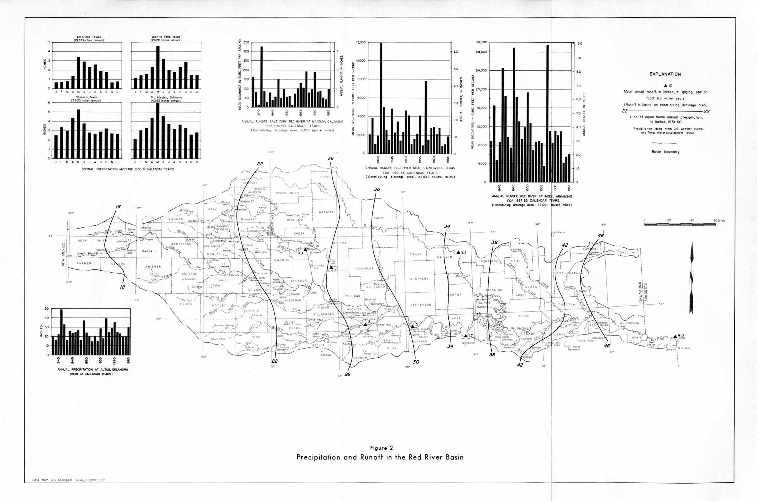
- Figure 2 - Precipitation and Runoff in the Red River Basin
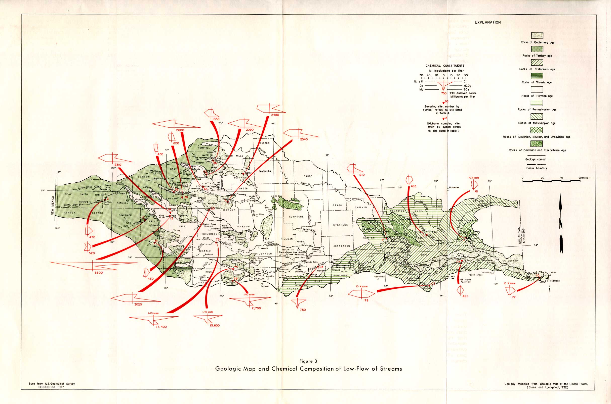
- Figure 3 - Geologic Map and Chemical Composition of Low-Flow of Streams
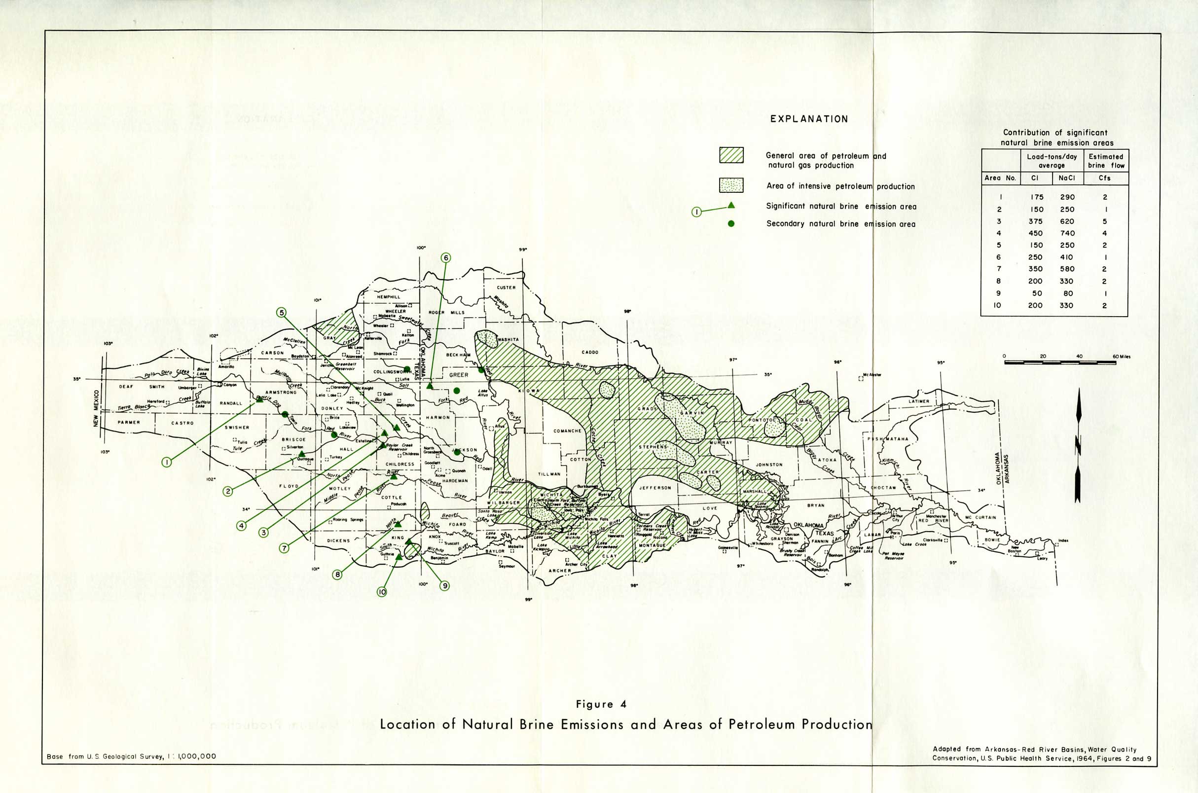
- Figure 4 - Location of Natural Brine Emissions and Areas of Petroleum Production
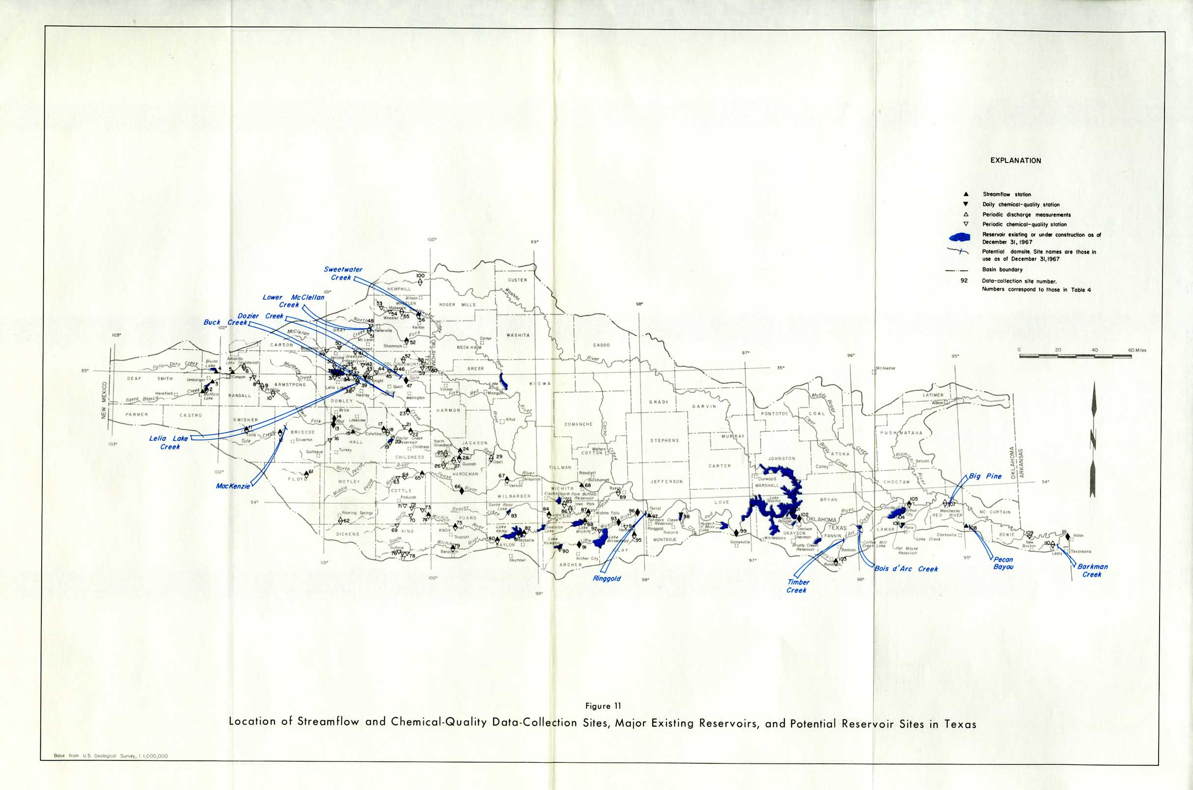
- Figure 11 - Location of Streamflow and Chemical-Quality Data Collection Sites, Major Existing Reservoirs, and Potential Reservoir Sites in Texas
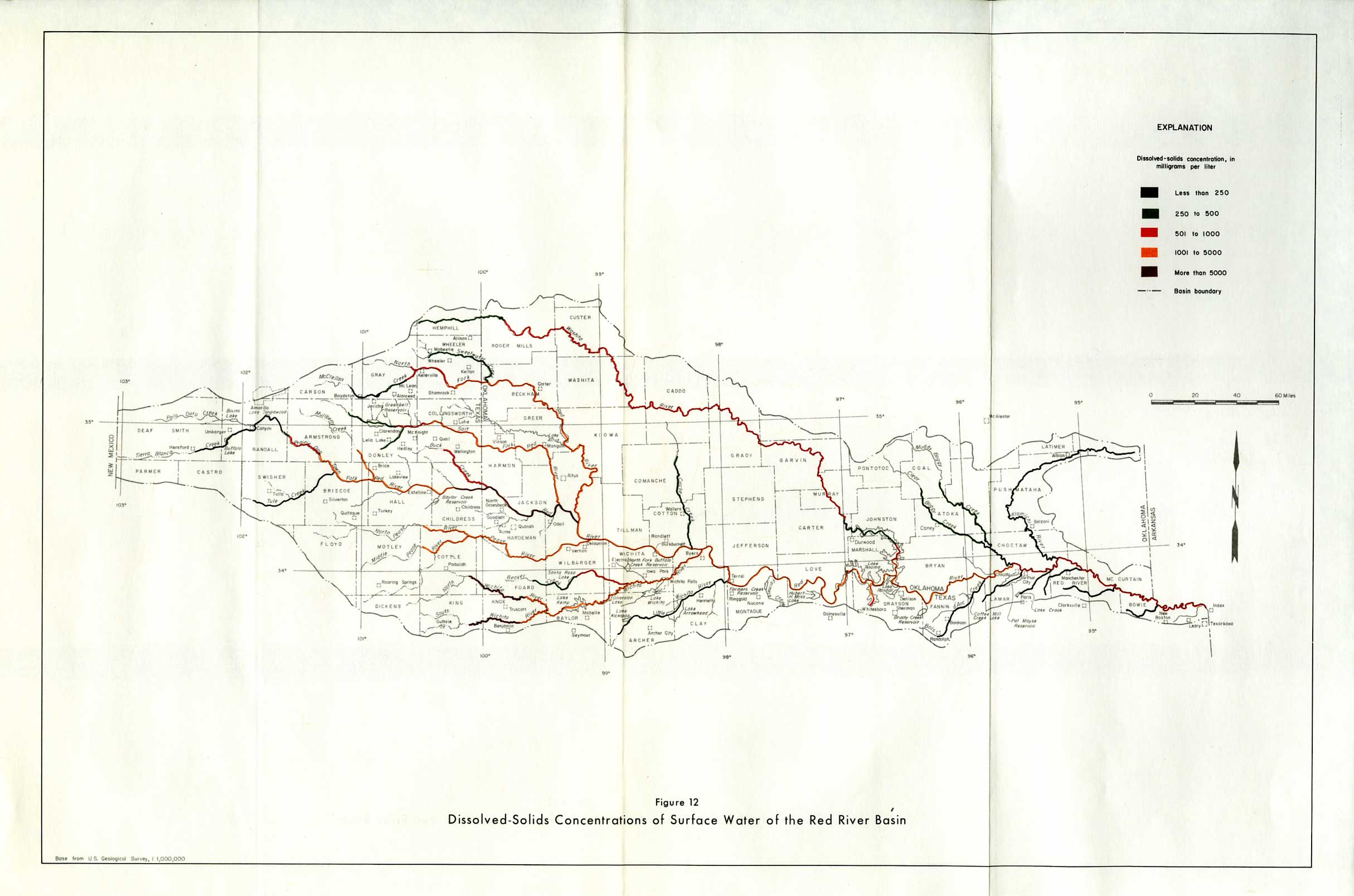
- Figure 12 - Dissolved-Solids Concentrations of Surface Water of the Red River Basin
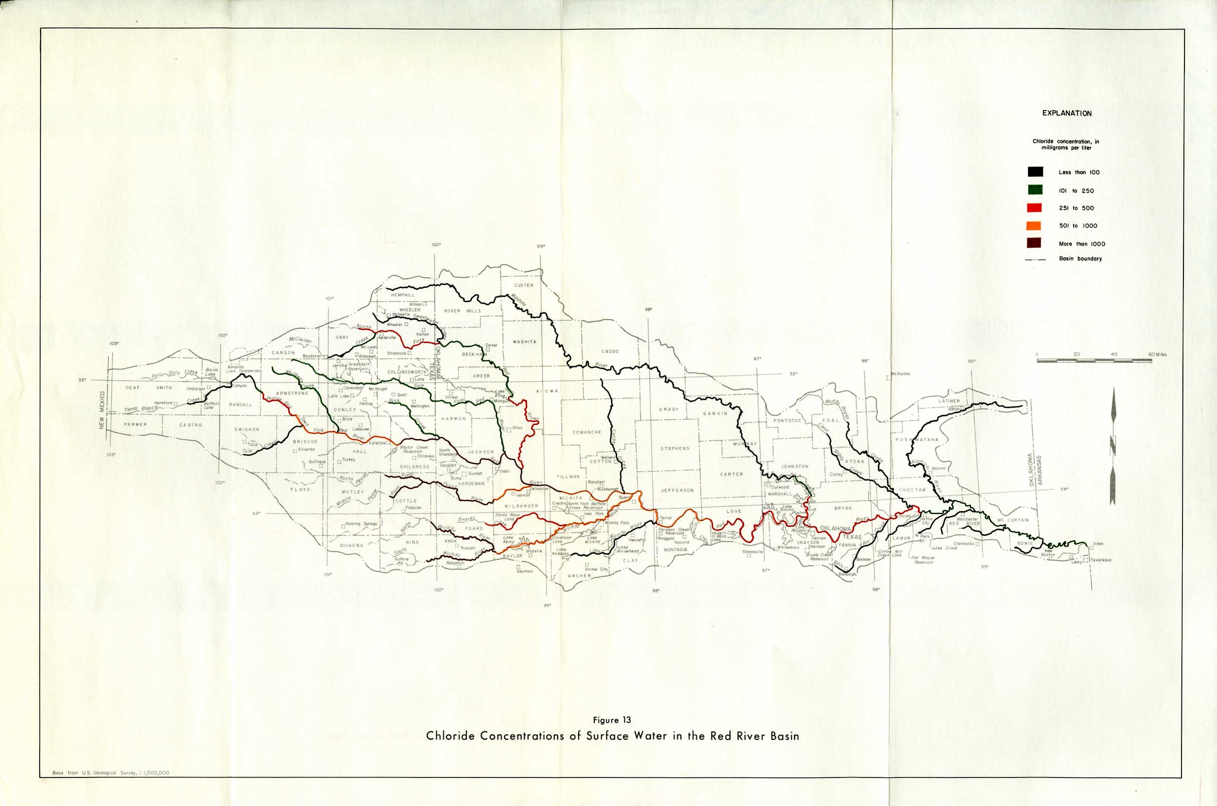
- Figure 13 - Chloride Concentrations of Surface Water in the Red River Basin
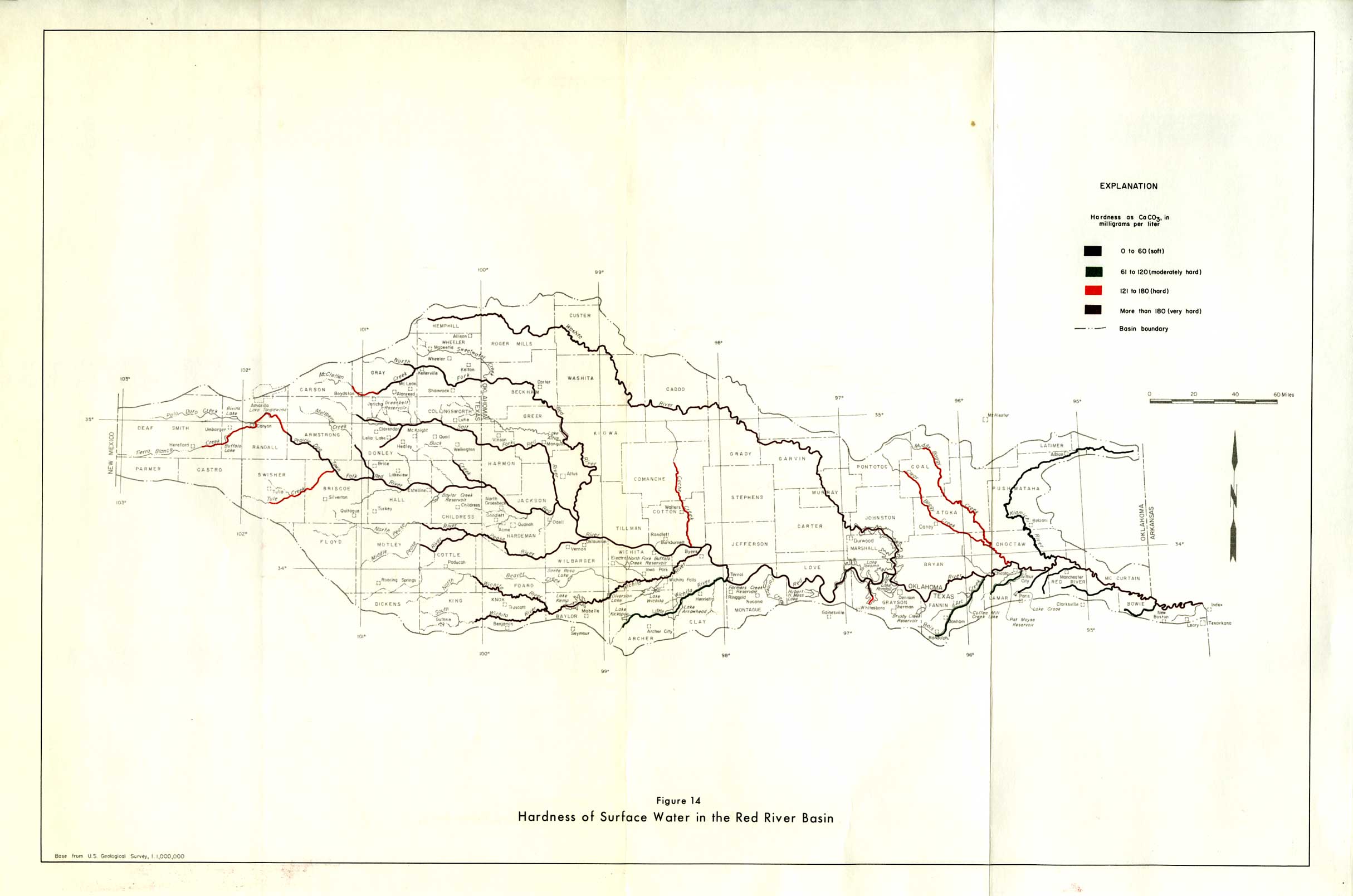
- Figure 14 - Hardness of Surface Water in the Red River Basin